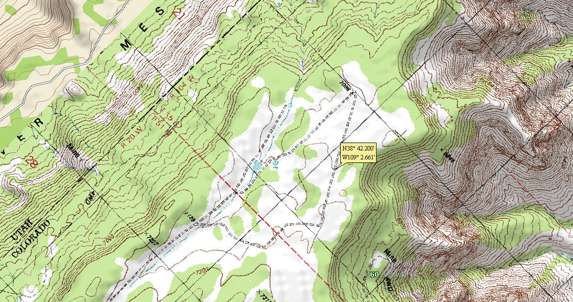
Dolores Point Airstrip
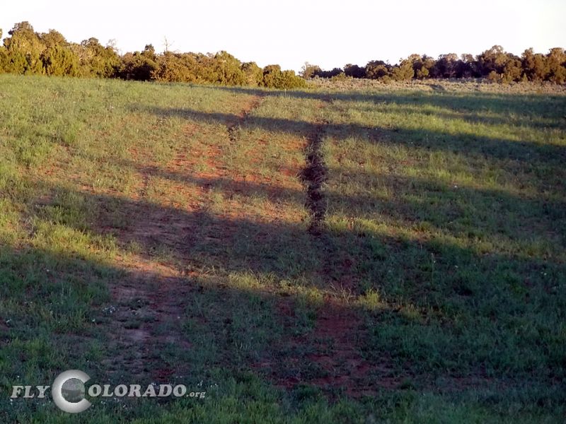
PIREP- DEC 2017: Caution: Deep tire Ruts exist on the runway due to a vehicle driving over the airstrip when it was wet. If possible, avoid using the runway until repaired.
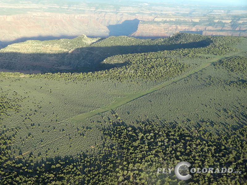
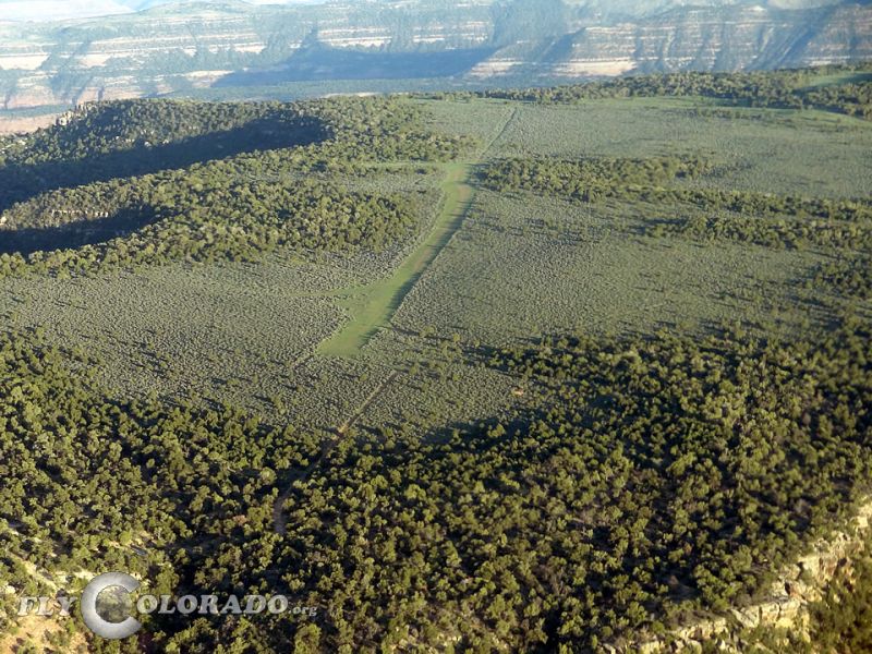
Near the Colorado and Utah state line sits a scenic airstrip high upon the tip of a mesa. Located 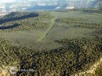 West of Gateway Colorado, Dolores Point will challenge most pilots and aircraft due to the uneven surface, high density altitude, and shifting winds. Once upon the ground you can peer west towards Castle Valley and the La Sal Mountains, or east towards the Dolores River and Uncompahgre Plateau for breathtaking views.
Dolores point was originally built back in the 1940’s by a gentleman named Wally Winfield, a WWII Air Force veteran turned uranium miner. He worked as a rancher and 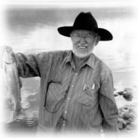 later in the Uranium Mining Industry in the Grand Junction and Gateway areas. He was tasked by the Atomic Energy commission to build the airstrip in order to connect the uranium mining community with services and supplies from cities such as Grand Junction and the surrounding area. Wally built the mile long airstrip using his own truck and tools and in exchange was allowed to build a house near the airstrip and his mining claim. Wally lived at Dolores Point until he moved down to the city of Gateway after the BLM forced him to leave in 1992. Up until the time of his passing in 2006 he was a common sight at the airstrip and would eagerly drive up the winding roads from Gateway to meet landing aircraft and show them around, share stories, or give them a lift in to town.
A short hike to the eastern canyon rim will give one an amazing view overlooking the Dolores River nearly 3000 feet below. You will also notice old mining equipment around the airstrip (and in the parking area). Dolores Point offers great camping. No water or facilities exist, but solitude is abundant. As with many backcountry airstrips, over flying the airstrip is recommended to check surface conditions and winds. On rare occasions, an ATV or Jeep will be using the airstrip as this is an active BLM road. Even though aircraft have the right of way, please be courteous and show respect. Wildlife and cattle may be present and pose a potential hazard.
Airfield Info: USE CAUTION FOR RUT
Airstrip Remarks:
-3 hills on runway
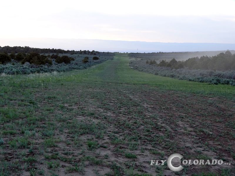
Runway Info:
Heading: 14/32
Dimensions: 3300'x40'
Surface: Dirt /Grass
Condition: Good
Landing Procedures: Recommend Land Rwy 14
Takeoff Procedures: Recommend takeoff Rwy 32
Remarks:
Departing the airstrip on runway 32 can be started both form the parking area or for STOL aircraft the high point 800ft north offers a clear view of the remaining runway. If you do depart runway 32 from the parking area, please be aware that the runway is not straight and jogs slightly to the left at the top of the hill. A departure down to the Hubbard airstrip offers a quick and thrilling flight. Please see the Hubbard airstrip for details.
Links / Recreation